


Nearest hamlets: Achentrias, Maridaki, Pera Tsoutsouras
Distance: 7.2km
Duration: 3 hours
Entrance coordinates: 34° 59.422'N / 25° 13.509'E (Achentrias)
Exit coordinates: 34° 59.051'N / 25° 16.842'E (Pera Tsoutsouras)
Trail type: Goat path and gorge bed. No markings (GPS tracker is a must)
Difficulty: Difficult
Recommended season: Spring, summer, autumn (beware of rainfall and high temperatures)
Amenities: Cafés at Achentrias, tavernas and seasonal accommodation at Maridaki and Tsoutsouras
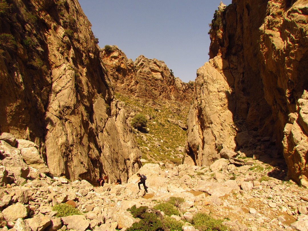
Two gorges start in Achentrias: ‘Ligiofarango’, which is dry and can be hiked across, and ‘Lichnistis’, which is suitable only for canyoning lovers. Ligiofarango can be hiked but there are difficult descents and ascents along the bed. The trail starts just outside Achentrias.
Hike through the fields and dry stones, following the goat trail and you will gradually enter the bed of the gorge, which you follow until the exit at Maridaki. Towards the end the two gorges converge and end along a joint bed leading to the beach. Shortly before the end of the second gorge, there is a series of five waterfalls. The last one, Lichnistis, is 60m high. Within Maridaki there is a spring that preserves the rich vegetation consisting of century-old plane trees and other water-loving plants. There are steps heading up from the spring to Tsoutsouras.
Download the kml file of the route in your device: (kml) Ligiofarango and Lichnistis
Achentrias
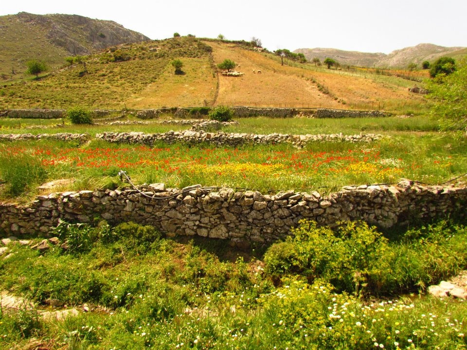
Achentrias or Ochentrias (the village with the many Ochentres, a non-venomous viper species found on Crete) is one of the most typical examples of a lively animal raising village in the Asterousia. It is located on a small, cultivated plateau to the west of Asfentylia and to the north of the cliffs and gorges that lead to the southern coastline. The aesthetic value of the plateau of Achentrias is matched by its ecological importance in preserving the biodiversity of the Protected Area of the Asterousia.
Most of the villagers are animal farmers and, to a lesser extent, work the land. The main products come from goats and sheep (meat, milk and various cheeses) and the excellent flavour and quality of the cheese produced here, at the uniquely built mitata (plural of mitato, stone huts on mountain peaks) of the area, is well known.
The village is downhill from Mount Asfentylias, an ideal juncture for the entire south of Crete, as there are but few obstacles. This is why a television broadcasting antenna was installed in 1970 on its 970.43m peak, which unquestionably affects the otherwise spectacular view towards the entire Mesara Valley, the Sea of Crete and the island of Dia. On this mountain, an ongoing survey by the Natural History Museum of Crete is after a very rare animal fossil, argued to have lived here, but has not been matched to any known animals until now.
Some of the most beautiful hiking trails of this mountainous zone start at Achentrias. Signs with maps and descriptions that will help you approach them safely are located at the starting points of the trails. The most beautiful trail is the one that has always connected Achentrias with the Holy Monastery of St. Nikitas, with the renowned palm forest and water spring, Kefalovrysi. Animal farmers continue to wash their sheep in the sea on St. Nikitas beach to this day, usually in late spring, in order to clean them.
Two more wonderful trails connect Achentrias with the seaside hamlet of Maridaki, through two gorges. One is Ligiofarango and the other Lichnistis.
Churches, celebrations
The village churches are those of Agios Dimitrios (St. Demetrius), Kimisis tis Theotokou (Dormition of Mary), Agios Charalambos (St. Charalambos) and Agios Ioannis Theologos (St. John the Theologian). On August 6 Achentrias celebrates the Transfiguration of Christ with a festival.
Maridaki
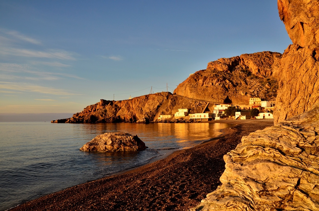
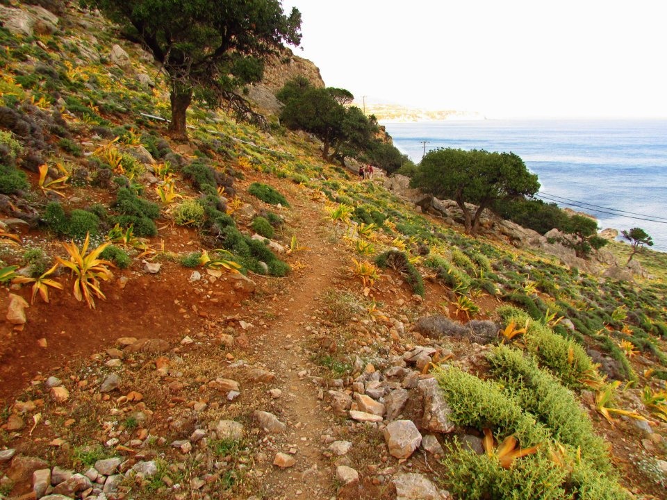
In terms of geophysics, Maridaki is quite impressive. It is essentially the estuary of two surface streams crossing two of the most beautiful gorges in the Asterousia, both of which start at Achentrias. These streams meet about 100m from the beach and form a small delta, with pebbles, levelling smoothly into the sea, forming a beach with blue waters, ideal for swimming. From the point where the two streams join and all along the estuary, there is rich vegetation of tall planes and other aquatic plants due to year-round water circulation. You can thus sit under the shade cast by the leaves and enjoy food and drinks in the small taverns which operate here in the summer. Besides the gorges that end up here, two seaside paths start at the settlement, one towards Tsoutsouras and one towards Agios Nikitas. They are both exceptionally beautiful and very accessible, even to inexperienced hikers.
Tsoutsouras
Tsoutsouras or Tsoutsouro (from the Venetian Zuzzuro) is located at the exit of the imposing Mintri Gorge. It is built at the location where the ancient city of Inatos, a port for Priansos, used to stand. This is also the location of the cave known as Fylakes, where Eileithya, the goddess of childbirth, was worshipped.
In Pera Tsoutsouras the coast is full of beautiful caves and unique karst formations. To the west of Tsoutsouras two parallel mountain peaks can be seen, which the locals call Zeus and Hera, as they remind them of two reclining bodies. This is the starting point of the Asterousia Mountain Range, which embraces the fertile southern valley of Mesara.