Distance: Achentrias - Pyrgos 22.8km, Achentrias - Treis Ekklisies - Pyrgos 37.4km
Entrance coordinates: 34° 59.454'N / 25° 13.420'E (Achentrias)
Exit coordinates: 35° 0.405'N / 25° 9.152'E (Pyrgos)
Difficulty: Achentrias – Pyrgos: Moderate, Achentrias – Treis Ekklisies – Pyrgos: Difficult
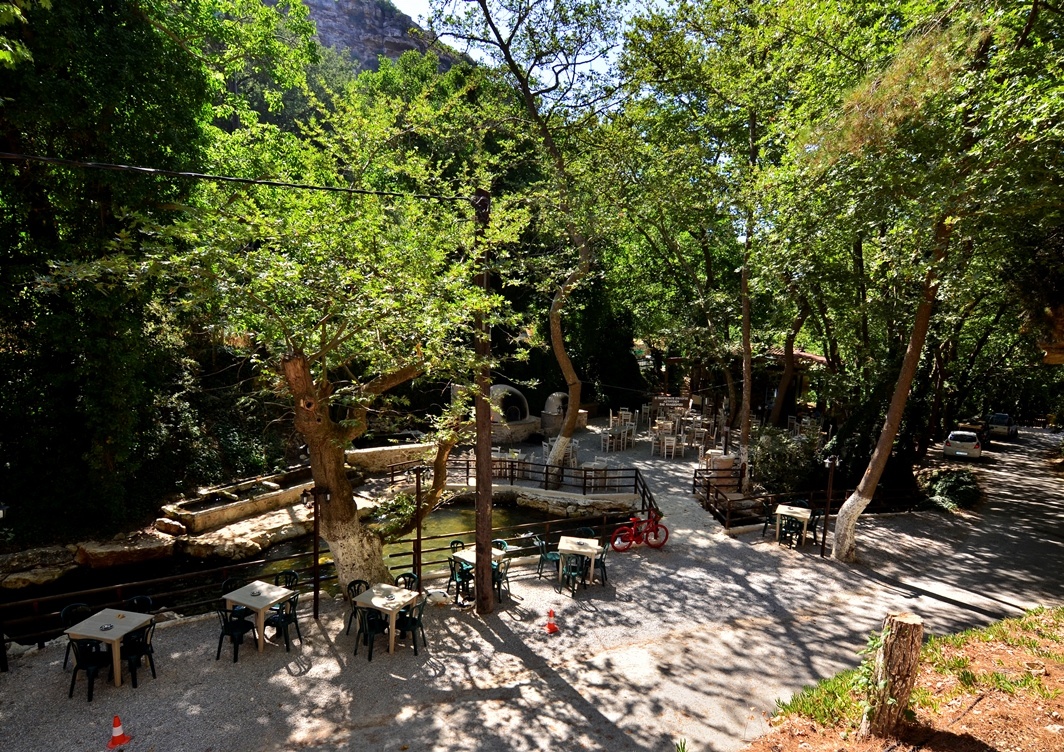
Amenities: Cafés at Achentrias. Taverns, cafés and accommodation at Pyrgos, where the Town Hall is also located
The route starts at Achentrias. It starts off uphill for 2.5 km with continuous, quick changes in incline, which reaches 9% at certain points. Then there is a continuous, mainly flat stretch of well-trodden dirt, with quick turns that lead to an impressive opening at the 4th km affording a view of the Libyan Sea.
After 6.3 km the route goes down a hill, passing through the cobbled alleys of Ethia, before entering a speedy descent on asphalt, and then re-entering the dirt, leaving a small gorge behind on the left and passing through the village of Mournia.
The descent continues until the 15th km where you can choose to turn left for a technically demanding descent towards Treis Ekklisies, down a 6.4km stretch of an average incline of 7.2%, and a maximum incline of 11%. You can also choose to continue straight on until the right turn to Prinia, where the last uphill stretch of the route, 3.1km at a 4.8% incline, starts, before the fast descent to the finish line at Pyrgos.
Download the kml file of the route in your device: (kml) Achentrias - Pyrgos
Achentrias

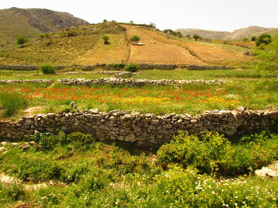
Achentrias or Ochentrias (the village with the many Ochentres, a non-venomous viper species found on Crete) is one of the most typical examples of a lively animal raising village in the Asterousia. It is located on a small, cultivated plateau to the west of Asfentylia and to the north of the cliffs and gorges that lead to the southern coastline. The aesthetic value of the plateau of Achentrias is matched by its ecological importance in preserving the biodiversity of the Protected Area of the Asterousia.
Most of the villagers are animal farmers and, to a lesser extent, work the land. The main products come from goats and sheep (meat, milk and various cheeses) and the excellent flavour and quality of the cheese produced here, at the uniquely built mitata (plural of mitato, stone huts on mountain peaks) of the area, is well known.
The village is downhill from Mount Asfentylias, an ideal juncture for the entire south of Crete, as there are but few obstacles. This is why a television broadcasting antenna was installed in 1970 on its 970.43m peak, which unquestionably affects the otherwise spectacular view towards the entire Mesara Valley, the Sea of Crete and the island of Dia. On this mountain, an ongoing survey by the Natural History Museum of Crete is after a very rare animal fossil, argued to have lived here, but has not been matched to any known animals until now.
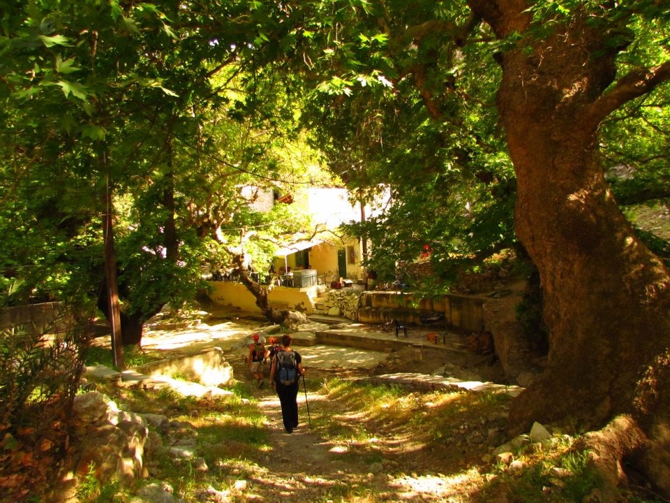
Some of the most beautiful hiking trails of this mountainous zone start at Achentrias. Signs with maps and descriptions that will help you approach them safely are located at the starting points of the trails. The most beautiful trail is the one that has always connected Achentrias with the Holy Monastery of St. Nikitas, with the renowned palm forest and water spring, Kefalovrysi. Animal farmers continue to wash their sheep in the sea on St. Nikitas beach to this day, usually in late spring, in order to clean them.
Two more wonderful trails connect Achentrias with the seaside hamlet of Maridaki, through two gorges. One is Ligiofarango and the other Lichnistis.
Churches, celebrations
The village churches are those of Agios Dimitrios (St. Demetrius), Kimisis tis Theotokou (Dormition of Mary), Agios Charalambos (St. Charalambos) and Agios Ioannis Theologos (St. John the Theologian). On August 6 Achentrias celebrates the Transfiguration of Christ with a festival.
Mournia
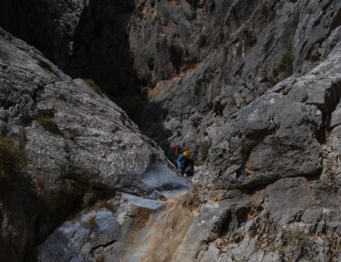
Lost in the greys and browns of the rocky Asterousia landscape, the small picturesque village of Mournia is almost uninhabited. You will come across it while driving between Paranymfoi and Ethia. It was established as early as 1853, when it was first mentioned in a Venetian administrative census. Mournia is the reference point for those who choose to go canyoning in the technical gorge of ‘Mesosfini’.
Treis Ekklisies (Three Churches)
This Asterousia village is famous for the Abas Gorge and waterfall which, when active (from the end of autumn to the end of spring) creates a 140m waterfall, the last carob tree forest on Crete and the astonishing beaches and coastline which stretch to the east and west of Treis Ekklisies.
Don’t be deterred by the number of buildings in this seasonal holiday settlement, as in addition to the astounding scenery and tours, you can enjoy meze dishes and raki in the small taverns. If you find yourself here during the annual August ‘kakavia’ [bouillabaisse] festival, you’ll certainly enjoy the local music and folklore dances. This settlement owes its name to its three churches [‘treis ekklisies’], Metamorfosi Sotira [the Transfiguration of the Saviour], Agios Georgios [St. George] and Panagia [the Virgin Mary].
Pyrgos
Distance from Heraklion: 49.5km
Amenities: Town hall, KEP [Citizens’ Service Centres], KAPI [Centres for the Open Care of the Elderly], police station, fire station, regional clinic, banks, post office, traditional taverns and cafés, shops, municipal canteen, lodgings, farmers’ market.
Pyrgos is the largest village at the foot of the Asterousia Mountain Range. It is the head village, where most citizen services for the residents of the southern part of the Municipality are to be found.
Its particularly favourable location played a definitive role in its growth and development into a central hamlet of the southern part of the Municipality, as well as of the broader region of Mesara. Built at the foot of the imposing Asterousia Mountain Range, in between and on top of hills that offered a good view of the entire valley, it secured its protection against intruders in times passed. The name itself (meaning Tower) indicates its fortifiable position, while, according to one account, it is connected to the Venetian Tower that was built at the peak of ‘Apano Pyrgou’, a rocky and barren hill to the east of the village.
Pyrgos is surrounded by 3 creeks with seasonal torrents that collect the rainwater on this side of the Asterousia, meeting the water supply needs of residents and the irrigation needs of their fields in Mesara, the most fertile valley on Crete, that spreads out at the feet of the village. The locals mainly work in farming, producing oil, table grapes and a cornucopia of vegetables.
Pyrgos is also a centre of cultural and other events for the villages of the southern part of the Prefecture of Heraklion, many of which are held at the man-made bocage to be found to the east of the village. Over the last few years the Pyrgos carnival has become an institution.
In Pyrgos there is also a children’s library, an interesting spot for children and young people to enjoy various activities.
What to see
- The hill of ‘Kakoplagos’: This is one of the hills on which Pyrgos is built and the point at which the old ill-preserved trail that used to connect Pyrgos to the village of Mournia starts.
- The hill of ‘Kefalas’: Another hill in Pyrgos at the peak of which stands the chapel of Agios Panteleimon (St. Pantaleimon). This is the starting point of the old and ill-preserved trail leading to the village of Prinia.
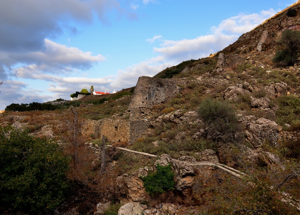
- The valley of Karava: Between the hills of Kakoplago and Kefalas there is a small valley, the valley of Karava, also known as Kavousi, with spring waters; it is rich in vegetation, mainly plane and walnut trees. The waters of Agios Mamas (St. Mammes) spring were channelled through pipelines and to run the flourmills that used to stand on the western side of Kakoplago. From there, the waters travelled along an arched hanging pipeline to the torrent on the opposite side and, continuing through another pipeline in the form of a chain, moved other flourmills. Rumour has it that there used to be 18 such flourmills. As they are horizontal mills, they are classified as Byzantine flourmills; while their architecture indicates that some were built during the Venetian rule, and others during the Ottoman rule, they always used the same construction style and architecture.
- ‘Ta Archontika’ (The Mansions) Hill with its off-white granite rock is where the local Venetian lord had his residence and where the area got its name from. Alongside and to the north of this mansion there was a spring that had been crafted into an intricate fountain for the water supply of the lord, which survived under the name ‘Archontissa’ (Lady). Few ruins of the residence and the fountain have survived, echoing the grandeur and aura of that age.
- Churches: The chapel of Agia Eirini (St. Irene) / the two-aisled chapel of Agios Georgios (St. George) and Agios Constantinos (St. Constantine) are decorated with noteworthy murals, while the dedicatory inscription displays the date 1314-1315. The church of Metamorphosis tou Sotiros (Transfiguration of the Saviour) and patron saint of the village (where, according to tradition, there used to be a convent)/ the chapel of Agios Raphail (St. Raphael) / the chapel of Agia Paraskevi (St. Paraskevi) and Profitis Ilias (Prophet Elijah).
- The Pyrgos Festival is held on 5-6 August.
Cafes