


Nearest hamlets: Astrakoi, Myrtia
Distance: 7.1km
Duration: 3 hours
Entrance coordinates: 35° 14.128'N / 25° 13.230'E (Kato Astrakoi)
Exit coordinates: 35° 16.412'N / 25° 12.251'E (Intersection with Kounaviano Gorge)
Trail type: Partially destroyed well-trodden trail. Markers on signs and rocks, some of which have faded
Difficulty: Moderate. Special care should be taken at specific points, and clothing must cover at least feet and legs.
Recommended season: Spring, summer, autumn. Be very careful in winter, because of rainfall.
Amenities: Taverns, cafés and accommodation at Astrakoi and Myrtia, which also houses Nikos Kazantzakis Museum
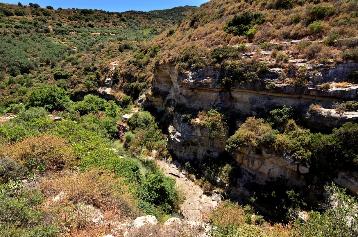
The section of Astrakiano gorge that we recommend in this trail starts at Kato Astraki. After Agios Georgios church there are stone steps leading to ‘Neraidospilio’ [Fairy-cave]. This is where the trail starts, running alongside the creek, with some basic crossing infrastructure at the difficult points along the way. The old Ottoman aqueduct is visible along the trail.
Pay close attention during the first kilometre after Neraidospilio, as the river and wild vegetation have destroyed some crossings. You also need to observe markings on the rocks so as not to miss a detour in the trail due to the crossing ahead having been completely destroyed. The trail runs parallel to the riverbed until half way along the route. After that point it runs high along the eastern slope of the gorge. The trail ends where the path meets the country road to Aitania, but you can continue to Karteros if you so wish.
Download the kml file of the route in your device: (kml) Astrakiano Gorge
Astrakoi
On the left bank of the valley of the River Karteros, there is the traditional hamlet of Astrakoi. In the past there used to be two parts, Pano and Kato (Upper and Lower) Astrakoi, but today only the Upper part is inhabited. The location has an unusual energy, enhanced by the presence of the old deserted Muslim quarters in Kato Astrakoi. If you follow the dirt road from the hamlet, leading here, you can see ruined traditional houses, the architectural features of which have remained the same since they were deserted by their inhabitants.
The oldest reference to the hamlet is found in a 1271 contract prepared by Chandax notary public Pietro Scardon. All Muslim inhabitants of Astrakoi left with the exchange of populations in 1924 and families from Asia Minor settled at the village.
Along the road leading to the village of Astrakoi in the deserted hamlet of Kato Astrakoi, there are the ruins of a three-aisled Byzantine church dedicated to St. George. At a distance of about 100 metres from it there is a ruined church of Panagia (Virgin Mary) with relics of icon paintings and a crown with four roses in relief, a depiction of a Byzantine double-headed eagle above its front door and the date 1555. Quite possibly, this crown was the coat of arms of the Kallergoi House, descendants of the grand Byzantine Phokas family.
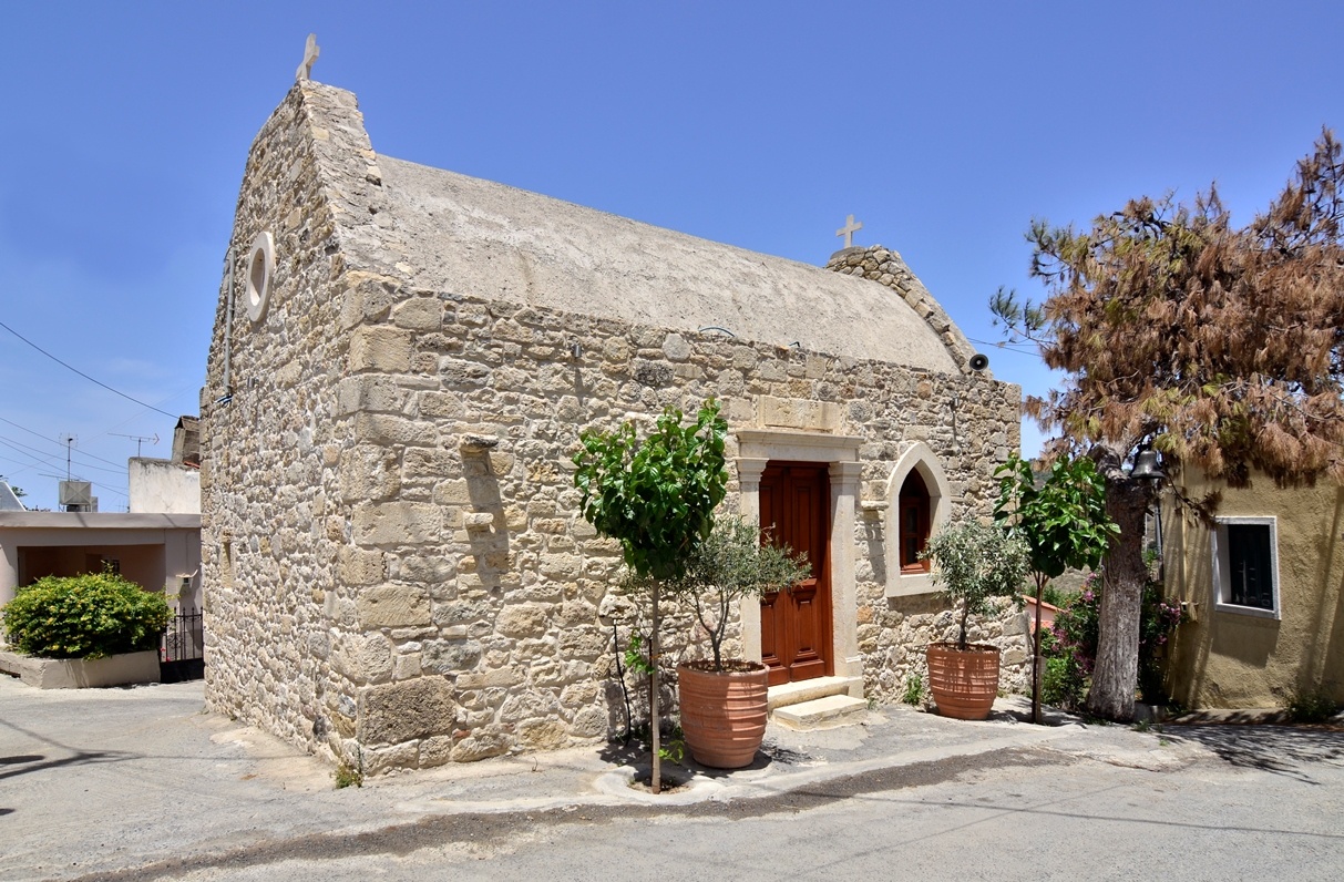
If you find yourself in the village, visit the church of Michail Archangelou (Archangel Michael) and look for the icon of St. Francis.
Very close to the hamlet, archaeologists brought to life part of a Minoan cemetery of the Mid-Palatial period (1380-1100 B.C.) with carved tombs, which contained clay box-like sarcophagi, ceramic vases and a stone lamp. Furthermore, in the same hamlet, at Kastrinakis location in Kaki Rahi, there has been partial excavation of the Early Geometric period (1100-900 B.C.) cemetery with burials in pits containing clay vases and objects made of iron.
Furthermore, below the village, at ‘Astrakiano Gorge’, north of the Astrakoi Bridge, there is the cave called Neraidospilios.
Astrakiano gorge
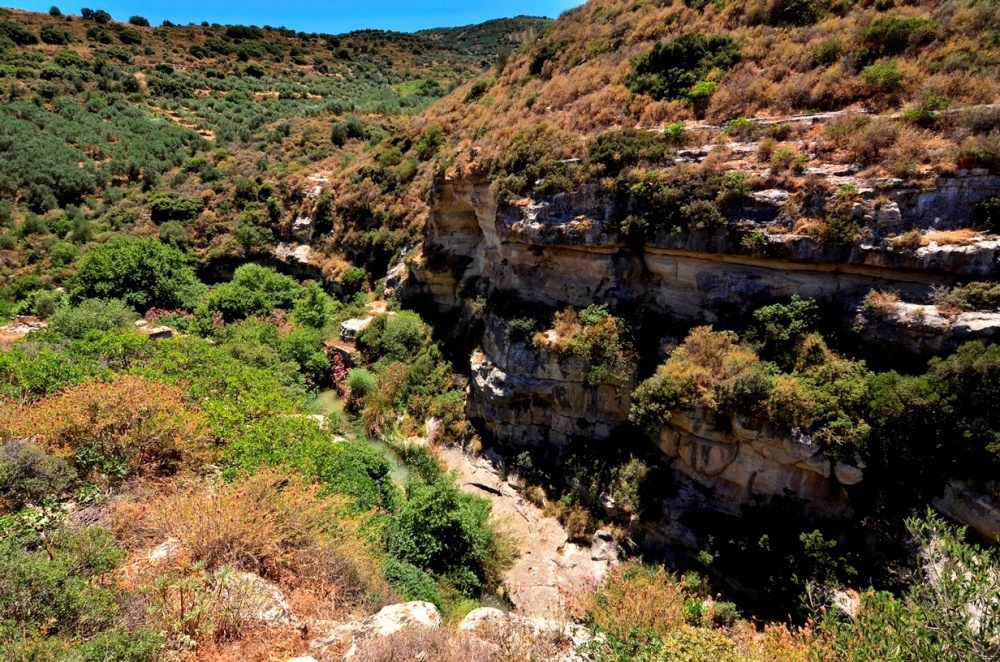
Vegetation in the gorges Knosano, Astrakiano and Kounaviano is wild and the waters rich; this is why there are so many mills and aqueducts from various historical periods accompanying hikers along whatever trail they choose.
The section of Astrakiano gorge that we recommend in "Hiking Trails" starts at Kato Astraki. After Agios Georgios church there are stone steps leading to ‘Neraidospilio’ [Fairy-cave]. This is where the trail starts, running alongside the creek, with some basic crossing infrastructure at the difficult points along the way. The old Ottoman aqueduct is visible along the trail.
Neraidospilios
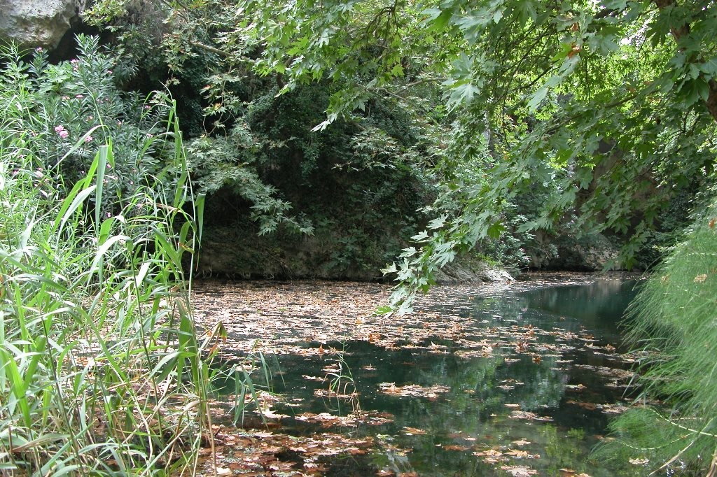
At ‘Astrakiano Gorge’, north of the Astrakoi Bridge, there is the cave called Neraidospilios. According to archaeologist Paul Faure, this was the sanctuary of Tritogeneia Athena. This adjective is due to the ancient Greek name of the River Karteros, i.e. ‘Triton’, who was born in the sanctuary of the goddess. In the cave there is one of the springs of the Astrakoi aqueduct, which supplied part of the water necessary for the city of Heraklion in the beginning of the 20th century. Legend has it that this cave, deeply set in the gorge with its numerous springs, clear running waters and lush vegetation, had been chosen by the Fairies (neraides, ancient Greek mythology Nereids) as their home! One night, a young lyre-player, heard their song and his curiosity led him to the cave. He saw the fairies there, dancing and singing bathed in light and dressed in transparent veils! Enchanted by the sweet melody in the air and their dance, he picked his lyre and accompanied their dance.